
Man and van in Doncaster, from Bradford
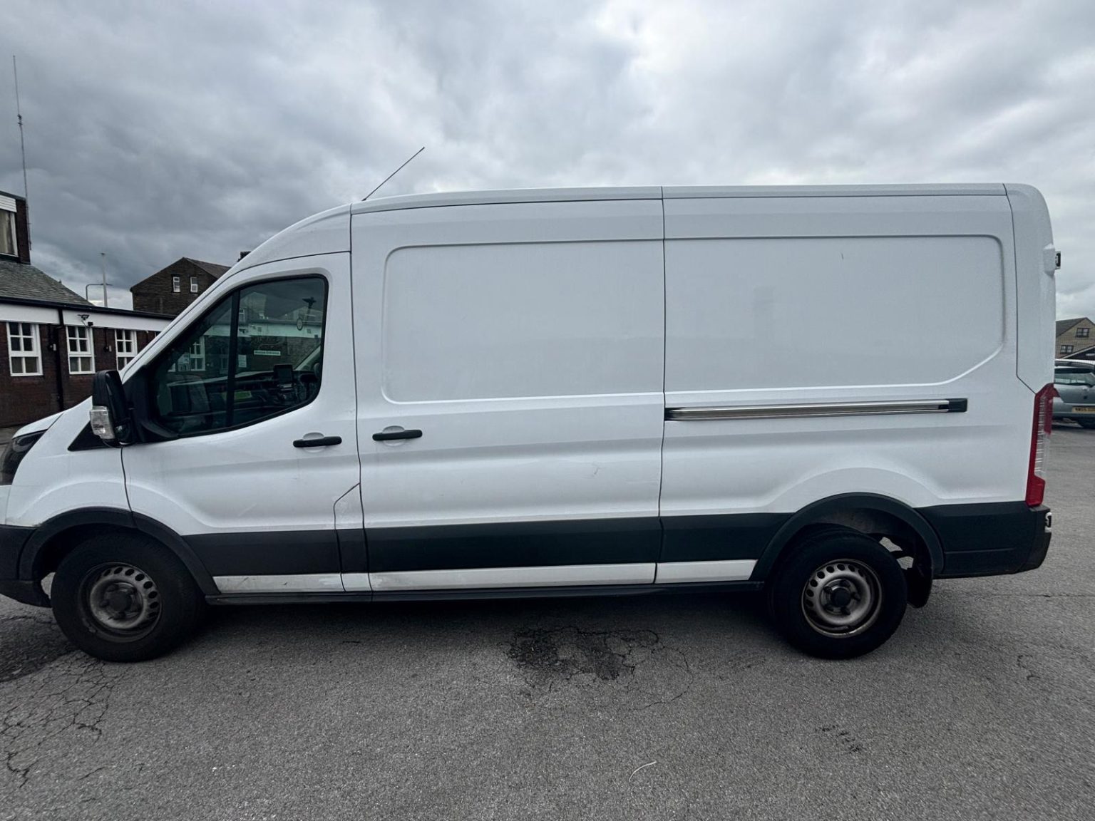
Man With Van Long Wheelbase is one driver and one Ford Transit long wheelbase van, based in Bradford, 41 miles from Doncaster (55-70 minutes by road). Jobs in Doncaster are quoted as one fixed figure, agreed before we set off, with the drive already in it.
Moving in Doncaster: what to know first
The centre is compact but awkward for a big van. Frenchgate, High Street and Baxter Gate are pedestrian streets, and the market trades around Market Place and the Corn Exchange on Tuesdays, Fridays and Saturdays. The on-street pay and display bays on Market Place, Copley Road and Netherhall Road are short stay. A flat above a shop is loaded from the nearest bay or a back street, and the furniture goes in on a trolley.
South of the centre, Hyde Park packs terraced houses in close rows off Carr House Road, on streets such as Childers Street and Jarratt Street, with cars along both kerbs. Hexthorpe, beside the old Plant Works, and the older end of Balby along Balby Road are similar rows. West of the station, the tower blocks off St James Street and Cleveland Street rise to 17 storeys at Silverwood House, so lift times and the walk to the kerb matter more there than the drive.
Further out the streets widen. Intake is a 1950s and 1960s council estate with long avenues off Sandall Beat Road, Wheatley Hills grew from the 1930s around The Grove, and Bessacarr and Cantley either side of Bawtry Road are mostly post-war private housing on quieter closes. Armthorpe's miners' houses sit in rings and crescents, and Bentley, two miles north, is a former pit village on the Askern Road.
Parking and access in Doncaster
City of Doncaster Council counts 2,335 resident priority bays in the town centre and 1,060 limited waiting bays, so many streets near the centre are permit or short stay. Open-air council car parks include the Markets car park on Market Road and Chappell Drive by the college. The Frenchgate car parks have a 2.135m headroom limit, and the van is about 2.5m tall, so it never goes in.
- Frenchgate, High Street and Baxter Gate are pedestrian, and the outdoor market trades on Tuesday, Friday and Saturday, with an antiques and bric-a-brac market on Wednesday mornings.
- On-street pay and display bays in the centre, on Market Place, Copley Road, Netherhall Road, Park Road, Chequer Road and East Laith Gate among others, are short stay.
- The Frenchgate multi-storey and rooftop car parks have a 2.135m headroom limit, below the height of the van.
- The tower blocks off St James Street and Cleveland Street, among them Silverwood House at 17 storeys and Cusworth, Firbeck and Sandbeck House at 14, depend on their lifts.
- Race days on Town Moor, above all the four-day St Leger meeting in September, bring extra traffic to Leger Way, Bennetthorpe and Bawtry Road.
Local details checked .
Man and van services we offer in Doncaster
Across DN1 to DN5 the van does house removals in Doncaster, flat moves from the St James Street towers and town-centre flats, furniture delivery from the York Road stores, student moves to and from University Campus Doncaster and trade runs to iPort and Wheatley Hall Road, each at a fixed price agreed first.
House Removals in Doncaster
Learn moreFlat & Apartment Removals in Doncaster
Learn moreFurniture & Large Item Transport in Doncaster
Learn moreStudent Removals in Doncaster
Learn moreBusiness Deliveries in Doncaster
Learn moreSofa & Bed Delivery in Doncaster
Learn moreEvery service we offer in Doncaster
All 11 of our services run in Doncaster, each with its own page covering how that job actually works here.
Parts of Doncaster we cover
Balby, Bessacarr, Bessacarr Grange, Cantley, Old Cantley, Wheatley, Wheatley Hills, Intake, Town Fields, Belle Vue, Hexthorpe, Lakeside, Armthorpe, Bentley, Bentley Rise, Sprotbrough, Cusworth, Scawsby, Scawthorpe, Warmsworth, Edenthorpe, Kirk Sandall, Long Sandall, Arksey, Toll Bar, Alverley, and everywhere in between. If your street isn't listed, it's almost certainly still covered.
Common Doncaster routes
- Doncaster → BradfordYork Road and the A638 to the A1 at junction 38, north to Ferrybridge, then the M62 and M606, about 41 miles
- Doncaster → SheffieldWhite Rose Way to M18 junction 3, the M1 at junction 32, then the A630 and A61, about 23 miles
- Doncaster → HullWheatley Hall Road and the A630 to M18 junction 4, then the M62 east and the A63, about 46 miles
- Doncaster → Yorkthe A19 and A638 north, the A1(M) and A64, about 42 miles
Frequently asked questions: man with a van in Doncaster
Can the van park in the Frenchgate car parks?
No. The Frenchgate multi-storey, entered from Church View, has a headroom limit of 2.135m, and the Transit stands about 2.5m tall. For a town-centre job the van uses an on-street bay, a loading point or an open-air council car park such as the Markets car park, and everything goes in on a trolley.
How much does a man and van cost in Doncaster?
Every Doncaster job gets one fixed price, agreed before the van leaves Bradford, with the drive in it. The figure follows the job: how much is going, the stairs or lift at each end and how far the load travels. A few photos and both postcodes are enough for a quote, and the prices page sets out what goes into one.
Does St Leger week affect a move?
It can. The St Leger meeting runs over four days in September at the racecourse on Town Moor, beside Leger Way, and the course holds around 35 race days a year. If you live near Bennetthorpe, Belle Vue or Intake, give the date when you ask for a price and the start time is planned around it.
What happens to furniture I am not taking?
It stays behind, because the van only carries what is going to the new address. City of Doncaster Council runs a bulky item collection you can book, and Doncaster Refurnish, which works with the council, collects household furniture from homes in the borough.
Nearby areas
Where the local details on this page come from
Checked on 24 October 2026 against:
- Doncaster (Wikipedia): town population 87,455 at the 2021 census (built-up area 160,220); postcode districts DN1 to DN12
- Balby (Wikipedia): suburb south-west of the centre, DN4; terraced housing nearer the town centre and post-war suburbs further out
- Bessacarr (Wikipedia): suburb on the south-east edge, DN4; mostly private housing from the 1960s; West Bessacarr south of Bawtry Road
- Cantley (Wikipedia): mostly built after the Second World War, 1950s semis and small terraces, some council estates
- Intake (Wikipedia): largely a council estate built in the 1950s and 1960s
- Wheatley Hills (Wikipedia): about two miles north-east of the centre, DN2
- Armthorpe (Wikipedia): large suburban village, DN3, population 14,457 in 2011
- Bentley (Wikipedia): suburb about two miles north of the centre, DN5; former mining village, colliery closed 1993
- Sprotbrough (Wikipedia): about 3 miles west of the centre, DN5; Sprotbrough Park on Park Drive; the A1(M) crosses the village
- Hexthorpe (Wikipedia): suburb very close to the town centre beside the Doncaster Plant Works, DN4; Urban Road
- Doncaster Racecourse (Wikipedia): also known as Town Moor; St Leger meeting held over four days in September, Thursday to Sunday
- Doncaster iPort (Wikipedia): at Rossington by junction 3 of the M18; 171 hectares for development including a rail terminal and warehousing
- Doncaster College (Wikipedia, redirected from University Centre Doncaster): The Hub campus on Chappell Drive, DN1 2RF, opened 2006, shared with University Campus Doncaster
- University Campus Doncaster: higher education division of DN Colleges Group, degrees and higher technical qualifications, The Hub
- A1(M) Doncaster Bypass: junction 35 for the M18, 36 the A630, 37 the A635, 38 the A638; the A1 continues to Darrington
- City of Doncaster Council, car parking (the live page blocks automated reading)
- City of Doncaster Council, Doncaster Markets (the live page blocks automated reading)
- City of Doncaster Council, bulky item collections (the live page blocks automated reading)
- Frenchgate Centre car parks: rooftop car park from West Laith Gate (340 spaces), multi-storey from Church View (846 spaces)
- StreetScan property record, Childers Street, Hyde Park: freehold terraced house; the street's houses are mostly terraces built between the early 1900s and the 1940s
- OpenStreetMap: street map, road data and driving routes
- postcodes.io (ONS data): postcode, ward and parish lookups for DN1 2BD, DN2 6LD, DN4 7ET and DN5 0AP