
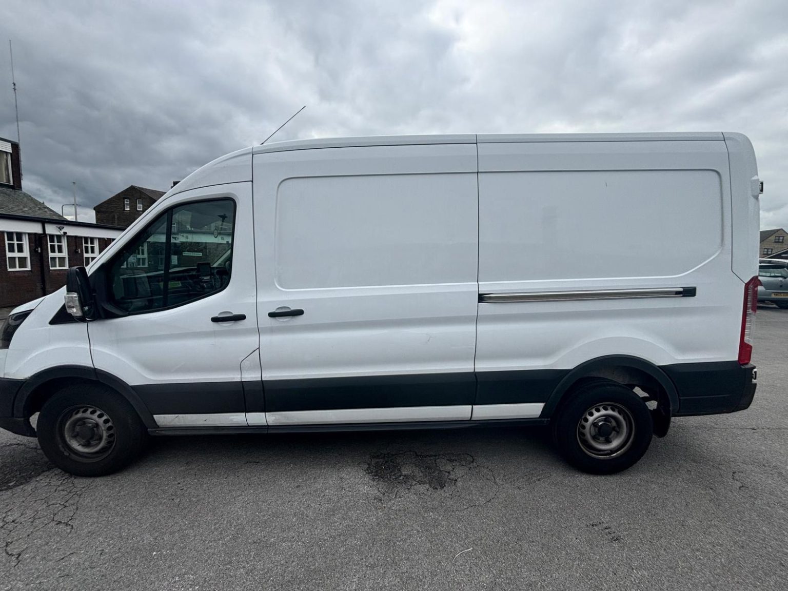
Our man and van in Dewsbury
Man With Van Long Wheelbase is one driver and one Ford Transit long wheelbase van, based in Bradford, 11 miles from Dewsbury (25-35 minutes by road). Dewsbury is inside our core area, so the drive is simply part of one fixed price agreed before we set off.
Moving in Dewsbury: what to know first
Savile Town, across Savile Bridge on the south side of the Calder, is late Victorian: long terraces, with some semis and detached houses among them. Batley Carr and Westtown have rows built for mill workers, with back lanes in places, and a few streets, Greenwood Street near Boothroyd among them, are still cobbled. Ravensthorpe grew up beside the mills on the western edge and was partly rebuilt after post-war clearance. Chickenley, the big post-war council estate, has estate roads where the van can normally pull up outside.
Dewsbury sits in the Calder valley and nearly every way out of the centre climbs. Halifax Road rises steeply towards Westtown, Heckmondwike Road runs along the hillside at Dewsbury Moor with side streets dropping away from it, and Wakefield Road reaches Earlsheaton through a cutting. Thornhill is on a ridge, so the village itself is fairly level, but the roads up from Thornhill Lees and the river are a pull. On a slope, tell us about the steps to your door before the day.
The A638 ring road circles the centre, and Market Place and part of Foundry Street are pedestrianised, so a flat or shop there is loaded from the nearest open street. The goods market trades on Wednesday and Saturday, 9am to 4:30pm. Kirklees Council is redeveloping the market and moving traders to a temporary site while the work goes on, so for a central job on a market day, give us the exact street and the van comes early.
Parking and access in Dewsbury
Town-centre car parks such as Crackenedge Lane and Railway Street charge for parking, and the van is about 2.5m tall, so any car park with a 2.1m height barrier is out. Terraced streets rarely have off-street space, so a neighbour keeping the kerb outside clear on the morning shortens the carry.
- Market Place and part of Foundry Street are pedestrianised, so central addresses load from the nearest open street, and Wednesday and Saturday are market days.
- Halifax Road (A638) climbs steeply out of the centre and Leeds Road (A653) climbs towards Shaw Cross, so homes off either can have steps or a sloping path to the door.
- Thornhill Lees is flat valley floor reached over Cleggford Bridge, while Thornhill sits on the ridge above, level in the village but a climb to get there.
- Heckmondwike Road (B6117) at Dewsbury Moor and Bradford Road (A652) at Batley Carr are busy through roads, so a house facing one is loaded from the nearest side street.
- The A638 ring road circles the centre, so the approach to a central address is worked out before the van arrives.
Local details checked .
Man and van services we offer in Dewsbury
For a move or a delivery in Dewsbury, start with house removals in Dewsbury, furniture delivery from Birstall Shopping Park or a local seller, student removals to Huddersfield or Leeds, or a same-day courier run when the diary allows. How a fixed price is worked out is on our prices page.
House Removals in Dewsbury
Learn moreFurniture & Large Item Transport in Dewsbury
Learn moreStudent Removals in Dewsbury
Learn moreSame-Day Courier in Dewsbury
Learn moreFlat & Apartment Removals in Dewsbury
Learn moreSofa & Bed Delivery in Dewsbury
Learn moreEvery service we offer in Dewsbury
All 11 of our services run in Dewsbury, each with its own page covering how that job actually works here.
Parts of Dewsbury we cover
Dewsbury town centre, Savile Town, Eightlands, Westtown, Westborough, Ravensthorpe, Scout Hill, Boothroyd, Dewsbury Moor, Batley Carr, Daw Green, Crackenedge, The Flatts, Eastborough, Earlsheaton, Chickenley, Shaw Cross, Chidswell, Thornhill Lees, Overthorpe, Thornhill, Thornhill Edge, and everywhere in between. If your street isn't listed, it's almost certainly still covered.
Common Dewsbury routes
- Dewsbury → BradfordWestgate and the A638 through Heckmondwike and Cleckheaton to Chain Bar, then the M606, about 11 miles
- Dewsbury → LeedsLeeds Road (A653) up past Shaw Cross, the ring road at Beeston and the M621, about 10 miles
- Dewsbury → WakefieldWakefield Road (A638) through Earlsheaton and Ossett, about 6 miles
- Dewsbury → HuddersfieldHuddersfield Road (A644) through Ravensthorpe to Cooper Bridge, then the A62, about 9 miles
Frequently asked questions: man with a van in Dewsbury
How much does a man and van cost in Dewsbury?
It is one fixed price, agreed before we set off, worked out from three things: how much is going, the access at each end (stairs, a long carry from the kerb, a path up a bank) and the distance between the two addresses. Dewsbury is in our core area, so there is no travel surcharge on top. Send photos and both postcodes for a figure; our prices page explains how quotes are built.
Can you load in Dewsbury town centre on a market day?
Yes, with an early start. Market Place and part of Foundry Street are pedestrianised, so the van waits on the nearest open street and the carry is from there. On Wednesday and Saturday the goods market trades from 9am, and with traders moving to a temporary site during the redevelopment, tell us the exact street when you book.
Do you cover Savile Town, Ravensthorpe and Thornhill as well as the town?
Yes. All of WF12 and WF13 is covered, from Savile Town, Westtown and Ravensthorpe to Thornhill, Earlsheaton and Shaw Cross, and so are Batley, Mirfield and Ossett next door. Give the full postcode and the nearest main road when you book.
Can you collect from Birstall Shopping Park and deliver to Dewsbury?
Yes. The shopping park, with the IKEA and Junction 27 Retail Park beside it, is about 4 miles north. Send the order number and collection details, and the items are carried into the room. New flat-pack is delivered boxed; we only take apart and rebuild furniture you already own.
Nearby areas
Where the local details on this page come from
Checked on 19 October 2026 against:
- Dewsbury (Wikipedia): market town in Kirklees on the River Calder, built-up area population 63,722 at the 2021 Census
- Savile Town (Wikipedia): suburb just south of the River Calder, late Victorian housing of long terraces
- Ravensthorpe (Wikipedia): western outskirts of Dewsbury, Dewsbury West ward
- Thornhill (Wikipedia): village on the southern outskirts of Dewsbury, on a ridge on the south side of the River Calder
- Thornhill Lees (Wikipedia): between Thornhill and the town centre, between the River Calder and the Calder and Hebble Navigation
- Listed buildings in Dewsbury (Wikipedia, from the National Heritage List): Cleggford Bridge carrying Thornhill Road (B6117) over the Calder
- Chickenley (Wikipedia): part of Dewsbury between Ossett and Dewsbury, its post-war council estate the largest in Dewsbury
- Batley Carr (Wikipedia): district in parts of Dewsbury and Batley that housed mill workers
- Birstall Shopping Park (Wikipedia): shopping park in Birstall with an IKEA store
- Dewsbury railway station (Wikipedia): on the main line between Leeds, Huddersfield and Manchester
- Kirklees Council, Dewsbury Market: new goods market every Wednesday and Saturday 9am to 4:30pm; the market is to be regenerated
- Kirklees Council: bulky household waste collections (furniture and white goods) booked with the council
- postcodes.io (ONS data): postcode, ward and parish lookups
- OpenStreetMap: street map, road data and driving routes