
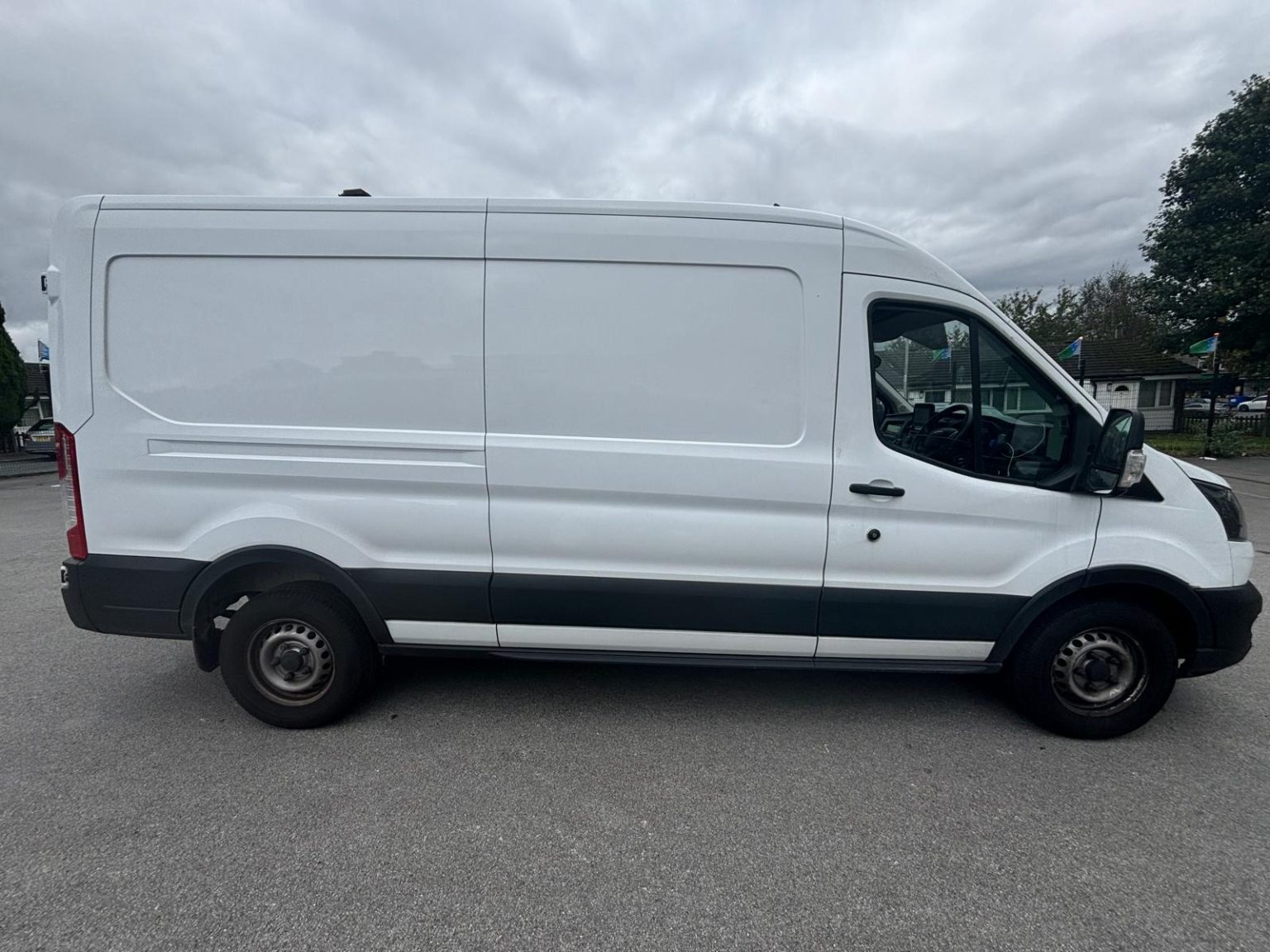
Man and van in Wigan, from Bradford
Man With Van Long Wheelbase is one driver and one Ford Transit long wheelbase van, based in Bradford, 51 miles from Wigan (65-80 minutes by road). Jobs in Wigan are quoted as one fixed figure, agreed before we set off, with the drive already in it.
Moving in Wigan: what to know first
North-west of the centre, Beech Hill, Springfield and Gidlow fall in the ward where terraces make up the largest share of homes, a little over four in ten at the 2021 census. South and west, Worsley Mesnes, Pemberton and the Newtown side of Douglas ward are mostly semis, half or more of the housing, on estates such as Hawkley Hall and Worsley Hall, where the van can usually stand close to the door.
East of the River Douglas, Scholes has a council estate and tower blocks, and the older streets around it, among them Roscoe Street, Rupert Street, Hunt Street and Molyneux Street, are cobbled. Poolstock grew up beside the canal for the mill workers of Trencherfield Mill. Wigan Council fines a vehicle parked with a wheel on the pavement at the £70 rate, so on narrow rows the van stays on the road and the trolley does the walking.
The middle of town is a mix of pedestrian streets and a ring of busy roads. Market Place is set in setts and closed to traffic, as are parts of Standishgate and Wallgate, so shops and flats there are loaded from a side street. North of the centre, Swinley has three controlled parking zones, enforced 9am to 5pm Monday to Saturday, and the Water Street multi-storey has a 1.95m barrier the van cannot pass.
Parking and access in Wigan
Wigan Council's penalty charge is £70 for parking or loading where restrictions are in force and for a wheel on the footway. Swinley's permit zones apply 9am to 5pm, Monday to Saturday. Council car parks in the centre are free at weekends, but the multi-storeys, Water Street at 1.95m among them, are too low for a van about 2.5m tall, so it waits on the street.
- Older streets in Scholes, such as Roscoe Street, Rupert Street, Hunt Street, Edwin Street and Molyneux Street, are cobbled.
- Market Place is a pedestrian street laid in setts, and parts of Standishgate and Wallgate are closed to traffic, so the van loads from a side street.
- Swinley has three controlled parking zones, W1 to W3, covering streets such as Kenyon Road, Swinley Lane and parts of Wigan Lane, enforced 9am to 5pm Monday to Saturday.
- The Water Street multi-storey has a 1.95m height limit, too low for a van about 2.5m tall.
- Robin Retail Park on Loire Drive sits beside The Brick Community Stadium, home of Wigan Athletic and Wigan Warriors, so collections there on a match day are better timed away from kick-off.
Local details checked .
Man and van services we offer in Wigan
Across WN1, WN3, WN5 and WN6 the van does house removals in Wigan, furniture delivery from Robin Park, flat moves around Wigan Pier and the centre, student moves out to Ormskirk, Manchester or Liverpool and Marketplace collection from terraces and estates, all at one fixed price agreed before the drive over.
House Removals in Wigan
Learn moreFurniture & Large Item Transport in Wigan
Learn moreFlat & Apartment Removals in Wigan
Learn moreStudent Removals in Wigan
Learn moreMarketplace & eBay Collection in Wigan
Learn moreSofa & Bed Delivery in Wigan
Learn moreEvery service we offer in Wigan
All 11 of our services run in Wigan, each with its own page covering how that job actually works here.
Parts of Wigan we cover
Pemberton, Lamberhead Green, Newtown, Marsh Green, Kitt Green, Worsley Hall, Norley Hall, Beech Hill, Springfield, Gidlow, Swinley, Marylebone, Wigan Lane, Whelley, Poolstock, Worsley Mesnes, Goose Green, Hawkley, Robin Park, Wallgate, Longshoot, Rose Bridge, Wigan Pier, and everywhere in between. If your street isn't listed, it's almost certainly still covered.
Common Wigan routes
- Wigan → BradfordScholes and Whelley on the B5238, the B5239 and A6 to M61 junction 6, then the M60, M62 east and M606, about 51 miles
- Wigan → Manchesterthe B5238 and A6 to the M61, then the M60 and M602 into the city, about 23 miles
- Wigan → Liverpoolwest on the A577 through Pemberton to the M58, then the A59, about 22 miles
- Wigan → Prestonthe A49 north to the M6, then the M65 and A6, about 19 miles
Frequently asked questions: man with a van in Wigan
How much does a man and van cost in Wigan?
Each Wigan job is given one fixed price before the van leaves Bradford, and the 51-mile drive along the M62 and M61 is already in it. What changes the figure is the job itself: how much is going, how far the van stops from the door, the stairs, and the distance to the new address. Photos and both postcodes are enough, and the prices page explains what goes into a quote.
Is one man with a van enough for a Wigan move?
For a flat, a terraced house or a few rooms, usually yes. The driver works with a trolley and straps, takes beds and existing flat-pack furniture apart and builds them again. If one piece is too heavy for a single person to carry safely, such as a solid wood dresser, mention it when asking for a price so the plan is settled first.
Can the van park on a cobbled street in Scholes or a terrace in Gidlow?
Usually, if it is not on a yellow line, in a bay without a permit or across a dropped kerb. Wigan Council charges £70 for a vehicle with a wheel on the footway, so the van stays on the carriageway and the furniture is trolleyed to the door. In the Swinley permit zones the rules apply 9am to 5pm, Monday to Saturday.
Do you take old furniture away after a Wigan move?
No, the van carries only what is going to the new home. Wigan Council gives each household two free bulky waste collections of up to five items a year, booked through MyAccount, with extra collections at £27, and usable pieces can go to a local charity.
Where the local details on this page come from
Checked on 25 October 2026 against:
- Wigan (Wikipedia): town population 107,732 (ONS); the town wards Douglas, Pemberton, Wigan Central, Wigan West and Worsley Mesnes
- Scholes (Wikipedia): east of the town centre across the River Douglas, noted for its council estate and tower blocks
- Poolstock (Wikipedia): residential area south of the River Douglas beside the Leeds and Liverpool Canal
- Hawkley Hall (Wikipedia): the hall in Pemberton was demolished in 1970 and the Hawkley Hall Estate housing estate stands on the site
- Pemberton (Wikipedia): area of Wigan on the south-west bank of the River Douglas, east of the M6, contiguous with Orrell
- Kitt Green (Wikipedia): suburb of Wigan, location of a Heinz food processing plant
- The Brick Community Stadium (Wikipedia): in Robin Park, home of Wigan Warriors and Wigan Athletic
- Winstanley College (Wikipedia): sixth-form college in Billinge Higher End, Metropolitan Borough of Wigan, 2,358 full-time students in 2023-24
- Edge Hill University (Wikipedia): campus-based university in Ormskirk, Lancashire
- Wigan & Leigh College campuses: Parsons Walk WN1 1RR; Centre for Advanced Technical Studies, New Market Street WN1 1RP; Pagefield Campus
- University of Lancashire partner page: Wigan & Leigh College degrees and foundation degrees awarded by the University of Lancashire
- ONS Census 2021, TS044 accommodation type (Nomis): Wigan borough 19.2% detached, 45.6% semi, 26.1% terraced, 7.4% purpose-built flats
- Wigan Council, controlled parking zones: W1 Swinley South, W2 Swinley North, W3 Swinley West, restrictions 9am to 5pm Monday to Saturday
- Wigan Council, penalty charges: higher level £70 for parking or loading where restrictions are in force, for a suspended bay
- Wigan Council, car park charges: Water Street multi-storey, Trencherfield Mill, Mona Street, Harrogate Street, Chapel Lane
- APCOA: Grand Arcade multi-storey car park, Crompton Street, WN1 1BH
- Wigan Council, bulky waste: two free collections of up to five items per property in 12 months, extra collections £27
- Wigan Council, employment land site maps: Martland Park and Heinz; Westwood
- TheIndustry.fashion, March 2021: Frasers Group bought Robin Retail Park in Wigan, with a large Sports Direct and an anchor Next store
- Sofology Bolton store: Middlebrook Retail Park, Bolton BL6 6JA
- OpenStreetMap: street map and driving routes
- postcodes.io (ONS data): postcode, ward and parish lookups for WN1 1BS, WN1 2HN, WN1 3UP and WN6 8AW