
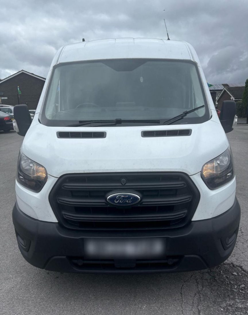
Man and van in Bury, from Bradford
Man With Van Long Wheelbase is one driver and one Ford Transit long wheelbase van, based in Bradford, 37 miles from Bury (50-65 minutes by road). Jobs in Bury are quoted as one fixed figure, agreed before we set off, with the drive already in it.
Moving in Bury: what to know first
Bury is the Greater Manchester town in BL8 and BL9, not Bury St Edmunds. Its centre is compact and partly closed to traffic: The Rock is paved and pedestrian through the shopping street, with South Back Rock as the one-way service road behind it, and Princess Parade and Market Street are pedestrian too. The outdoor market by Murray Road trades on Wednesday, Friday and Saturday, so a flat above a shop there is loaded from a side street or a council car park rather than the front door.
Round the old mills the housing is terraced. Elton, Fishpool and Free Town have long rows off Bolton Road, Walshaw Road and Tottington Road, where cars line both kerbs by teatime and a long van needs the space outside the door kept free. Manchester Road and Silver Street keep older brick terraces close to the centre, and the Garside estate west of Brandlesholme Road is a council estate of terraced houses.
Further out the streets open up. Walmersley, along the A56 north of the centre, is mostly post-war housing, and Unsworth to the south grew from the 1950s around Sunny Bank Road. Brandlesholme has larger estates round Trimingham Drive and Rudgwick Drive, and the newer housing at Chesham, Limefield and Redvales is laid out in closes, where the van reverses in while it is still empty and leaves the road clear.
Parking and access in Bury
Bury Council lists 12 car parks in and around the centre: nine in the town centre, among them Market with 310 spaces and Trinity Street with 221, plus Bolton Street Station, Castle Leisure Centre and Moorgate. Parking is free from 6pm until 8am, and town-centre car parks charge a flat £1.50 on Sundays. The Rock and Mill Gate car parks are multi-storeys; the van is about 2.5m tall and does not go under a 2.1m barrier, so it uses a surface car park or the street.
- South Back Rock is the one-way service road behind The Rock, and the way in for loading the shops and flats along it.
- The outdoor market by Murray Road trades Wednesday and Friday 9am to 4.30pm and Saturday 9am to 5pm, and the Fish and Meat Hall opens Monday to Saturday, while the Market Hall is closed over RAAC.
- Terraced streets in Elton, Fishpool and Free Town are parked on both sides by evening, so the space outside a house is best kept free from the night before.
- Gigg Lane is home to Bury FC again since 2023, and the closes beside it, such as Sussex Drive and Kent Drive, fill with cars on match days.
- The M66 has junctions at Walmersley (1, for the A56), the A58 for the centre (2) and Pilsworth (3), and joins the M60 and M62 at Simister Island.
Local details checked .
Man and van services we offer in Bury
Across BL8 and BL9 the van does house removals in Bury, flat moves from rooms above town-centre shops, student moves to Manchester halls and back, furniture delivery from the town-centre and Woodfields stores and business deliveries round Pilsworth and the M66, each at one fixed price.
House Removals in Bury
Learn moreFlat & Apartment Removals in Bury
Learn moreStudent Removals in Bury
Learn moreFurniture & Large Item Transport in Bury
Learn moreBusiness Deliveries in Bury
Learn moreSofa & Bed Delivery in Bury
Learn moreEvery service we offer in Bury
All 11 of our services run in Bury, each with its own page covering how that job actually works here.
Parts of Bury we cover
Elton, Fishpool, Free Town, Brandlesholme, Walmersley, Chesham, Redvales, Limefield, Pimhole, Fernhill, Woolfold, Walshaw, Unsworth, Sunny Bank, Moorside, Jericho, Fairfield, Blackford Bridge, Gigg, Buckley Wells, Nangreaves, Higher Woodhill, and everywhere in between. If your street isn't listed, it's almost certainly still covered.
Common Bury routes
- Bury → Bradfordthe A58 to the M66 at junction 2, south to Simister Island, then the M62 east and the M606, about 37 miles
- Bury → ManchesterAngouleme Way to the M66, the M60, then the A56 Bury New Road into the city, about 11 miles
- Bury → BoltonJubilee Way, then the A58 Bolton Road and Bury and Bolton Road, about 6 miles
- Bury → Ramsbottomthe B6214 Crostons Road, Brandlesholme Road and Longsight Road, about 5 miles
Frequently asked questions: man with a van in Bury
Is this the Bury near Manchester or Bury St Edmunds?
The Bury in Greater Manchester, with BL8 and BL9 postcodes, about 11 miles north of Manchester city centre. The van comes from Bradford, 37 miles away by the M62 and M66. Bury St Edmunds in Suffolk is a different town and is not covered by these Bury pages.
How far is Bury from Manchester, and can you move me between the two?
Yes, and it is about 11 miles by road, on the M66 and M60 and then the A56 Bury New Road. A move from a Manchester flat to a Bury house, or the other way, is quoted like any other: both addresses, the floors, and what is going.
Can the van stop outside a flat on The Rock or by the market?
Not right outside, as that stretch is pedestrian. The van waits on a side street or service road such as South Back Rock, or in a council car park like Market or Trinity Street, and the furniture goes in by trolley. The multi-storey decks at The Rock and Mill Gate are no use, as the Transit stands about 2.5m tall.
What won't you move from a Bury house?
Gas cookers, dishwashers and anything hard-wired, plus tall and American fridge-freezers, which are not moved. Unwanted furniture is not taken away either: Bury Council runs a paid bulky household waste collection for that. Everything else that fits the 3.4m load floor is loaded, carried and unloaded for the fixed price.
Where the local details on this page come from
Checked on 24 October 2026 against:
- Bury, Greater Manchester (Wikipedia): population 81,101 at the 2021 census; areas including Chesham, Elton, Fairfield, Fernhill, Fishpool, Free Town
- Bury Market opening times: outdoor market Wednesday and Friday 9am to 4.30pm, Saturday 9am to 5pm
- Bury Market (Wikipedia): open-air market on Wednesdays, Fridays and Saturdays, beside the Mill Gate shopping centre
- Bury Council, car parks in Bury town centre: 12 council car parks, nine in the town centre (Castle, Foundry Street 135 spaces, George Street, Irwell Street)
- The Bury Directory (Bury Council): bulky household waste collection booked with the council, charged, non-refundable once booked
- Brandlesholme (Wikipedia): area of Bury; Garside estate, a council estate of terraced houses west of Brandlesholme Road
- Walmersley (Wikipedia): northern suburb of Bury on the A56 Walmersley Road; much of the housing post-war; Christ Church (1883)
- Unsworth (Wikipedia): south of Bury town, population 11,034 (2021, ward)
- Bury College (Wikipedia): further education college on Market Street, BL9 0BG, Woodbury and Millennium centres
- Holy Cross College (Wikipedia): Catholic sixth form college on Manchester Road, Bury, BL9 9BB
- Gigg Lane (Wikipedia): football ground built for Bury F.C. in 1885, Bury's home 1885 to 2019 and again from 2023
- M66 motorway (Wikipedia): junction 1 A56 Walmersley and Bury, junction 2 A58 Bury, Heywood and Rochdale, junction 3 Unsworth and Heywood
- Simister Island (Wikipedia): interchange at junction 18 of the M60 with the M62 and M66
- Bury Interchange (Wikipedia): bus station and Metrolink stop, bus entrance on Haymarket Street and exit to Angouleme Way
- Fallowfield (Wikipedia): large student population, University of Manchester Fallowfield Campus and Owens Park halls, Wilmslow Road
- Place North West: Park 66 retail and industrial scheme at Pilsworth, off M66 junction 3
- OpenStreetMap: street map, road data and driving routes
- postcodes.io (ONS data): postcode, ward and parish lookups for BL8 2QF